

Event: Friday Seminar: "Density, Defense, Agriculture and Access: Lessons from LiDAR in the Maya lowlands"
Date & Time
December 1, 2017 - 4:00pm to 6:00pmContact Information
Matthew Swansonmswanson@ioa.ucla.edu
Location
Fowler A222Event Type
Friday SeminarEvent Details
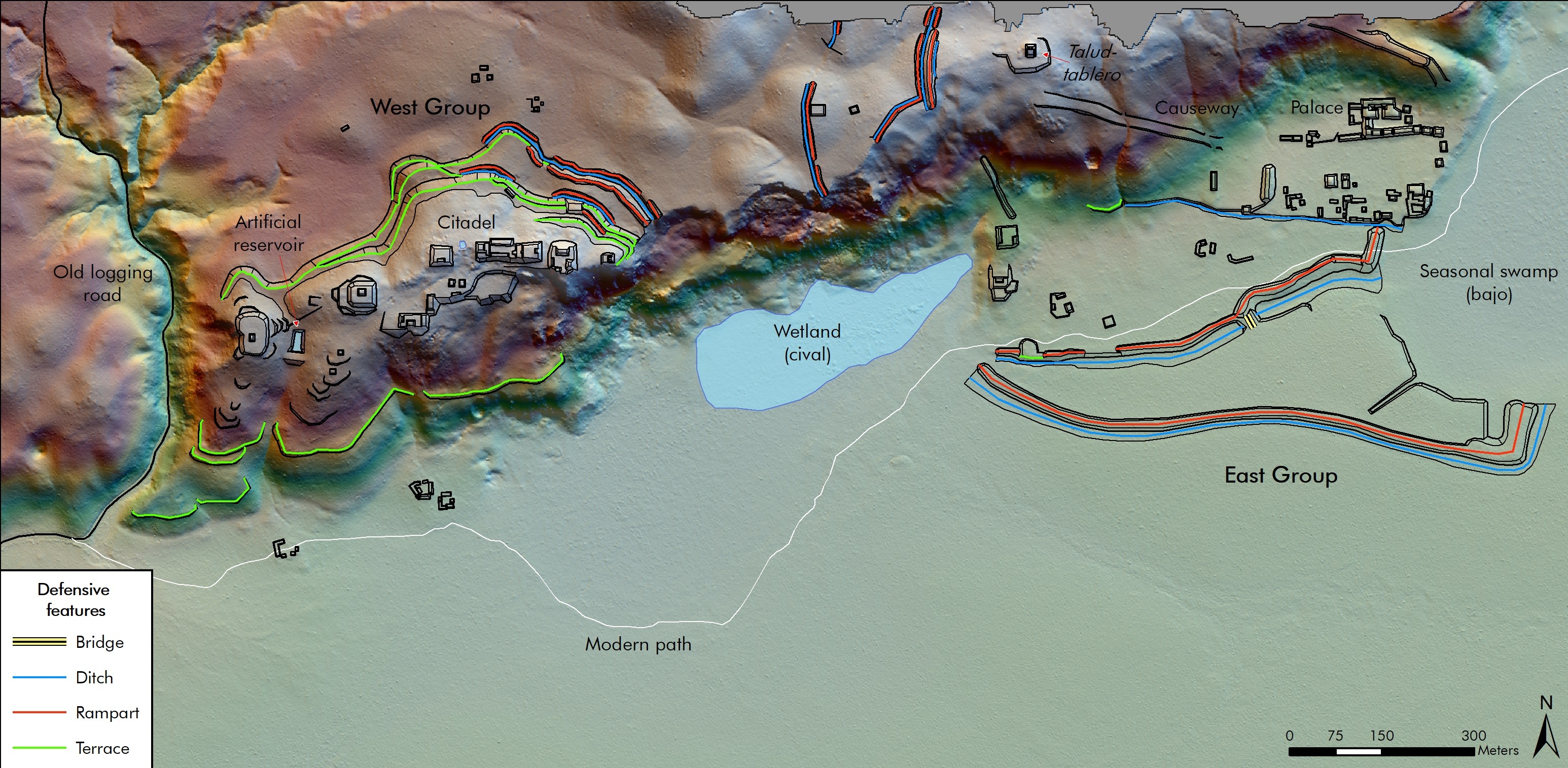
Speaker: Dr. Thomas Garrison, Ithaca College
In 2016, the National Center for Airborne Laser Mapping (NCALM) acquired over 2100 square km of data over the Maya Biosphere Reserve in Guatemala, representing the largest single LiDAR acquisition for archaeological research. Sponsored by PACUNAM, a consortium of scholars representing different archaeological projects and nationalities have come together to analyze broad trends across the ten individual polygons covered by the data. Notable among the findings are patterns of settlement density and vacancy, an uneven distribution of intensive agricultural systems, and variations in regional connectivity and disconnectivity. A final aspect of the data, seen prominently around the ancient Maya kingdom of El Zotz, is the presence of elaborate systems of site defense. This talk will highlight some basic findings by members of the PACUNAM LiDAR Initiative (PLI) before focusing on what these data tell us about Maya warfare, defense, and politics. Particular attention will be paid to the discovery of a true Maya fortress, dubbed La Cuernavilla, and the implications this site has for understanding Maya politics in the aftermath of Teotihuacan's entrada into the lowlands in the 4th century A.D.